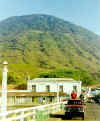
 $29 for a
round trip charter. No life jackets or safety instructions. Loading up on Isla
Zacate Grande, an extinct volcano joined to the mainland by a road through
the mangroves.
$29 for a
round trip charter. No life jackets or safety instructions. Loading up on Isla
Zacate Grande, an extinct volcano joined to the mainland by a road through
the mangroves.Isla "El Tigre"
Sunday - March 21, 1999
 $29 for a
round trip charter. No life jackets or safety instructions. Loading up on Isla
Zacate Grande, an extinct volcano joined to the mainland by a road through
the mangroves.
Who is The Skipper?
 Zacate
Grande recedes into the distance.
 Port
of Amapala. We stop to refuel (gasoline from a jug). Dark rocks on
dock show water level at high tide. Click here for
view of map.
 Mitch
appears to have triggered a mudflow from the slopes of the dormant
volcano. Bird experts John and Tim assure tourists that the white material on
the rocks and trees of Isla El Pacar (left of photo) is neither
ice nor snow. At low tide, a narrow strip of sand connects this small island to El
Tigre.
 "You all
rode out to an island in that? You are braver than I
thought" Passengers disembark at Playa Grande from The
Minnow. Shelagh is aided by the captain and Roy. Isla El
Pacar is visible, center right of photograph.
 Playa
Grande beach at low tide (note bare rocks exposed above water line).
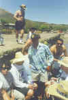
Charter captain loads passengers for Zacate Grande, promising to
return in 2 hours (he has not yet been paid). Water does not appear particularly
inviting. Some of the locals are swimming, but tourists find beachfront tables in
the shade.
 Come to
think of it, there are no signs prohibiting animals on the beach.
 Rising
tide and wind combine to prevent charter boat from rounding Isla Picar.
Pick-up trucks provide overland transportation for tourists to the Port of Amapala,
where our cruise ship is waiting. No, this is not the truck we rode.
Apparently open pick-up beds are a common means of transportation at this tropical
paradise.
 Corn field
on Zacate Grande with a view of the mangroves and shrimp farms.
 Mangroves
up close. When we drove through this area 4 hours earlier, the water was 2 meters
lower and lots of mud was exposed.
 Mitch took
out the road from Zacate Grande to San Lorenzo
and the Panamerican Highway. This area is where the deltas of the Río
Choluteca and Río Grande have built up a nearly
level plain of sediments into the Golf of Fonseca.