 Floodplain
of the Choluteca River near Marcovia. Weeds grow from sand moved in during the late
October floods.
Floodplain
of the Choluteca River near Marcovia. Weeds grow from sand moved in during the late
October floods.Marcovia Floodplain
"You can observe a lot just by watching." - Y. Berra.
 Floodplain
of the Choluteca River near Marcovia. Weeds grow from sand moved in during the late
October floods.
 On gently
sloping ground nearby, clay was deposited by flood waters.
 A change
in slope at the foot of a scarp marks the edge of the "geological"
floodplain. Above the nick point are located "older alluvium" on which
Marcovia Nueva is being constructed.
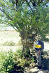
 Gary
examines sugar cane debris caught in a Jícaro tree, evidence of high water.
 Edge of
clay marks high water mark. The nick point in the slope that marks the edge of the
geological floodplain lies at least 2 meters higher up. This gap between the high
water mark from Mitch and the nick point can be followed for several hundred meters.
A reasonable person could conclude that Mitch was not
the most powerful flood to occur in this location during the recent (geological) past.
 View from
higher up. Note gap between nick point at base of scarp and high water mark (edge of
clay deposit).
 Is this
what Mitch flood waters would have looked like from this spot on a sunny day early last
November? Other colors might be more appropriate for water carrying a heavy load of
silt and clay.
 View from
the middle of the floodplain. Rotting sugar cane is everywhere - the place smells
like a rum factory. Irrigation ditches are ruined and buildings destroyed.
Smoke in the distance rises above cane fields (some were not destroyed by the
flood) being burned before harvest.
 Boulders
the size of bowling balls lie on top of rotting cane. How fast does water have to
flow in order to roll around rocks this large?