Tegucigalpa before Mitch
Note: these are scans of 35mm slides of varying quality. Some images have been processed with Microsoft Photo Editor and/or Paint Shop Pro. Some of these shots were taken because the author has learned to recognize some landslides. Human activities (digging, grading) frequently obscure geomorphic evidence useful to geologists in identifying landslides. However, the fundamental hazards remain largely unaffected by shallow surface excavations.
Now that it has become apparent to all that building homes in dangerous locations is very costly, (1) maps delineating landslide and flood hazards should be prepared, (2) laws regulating human activities on hazardous ground should be passed, and (3) those laws should be enforced. Landslides and floodplains need not be abandoned - uses must be identified that are compatible with the risks posed. (Mayor Carty Finkbeiner outlines Toledo's aid project!)
December,
1969: View toward northwest from Cerro Juana Laínez. Puente Mallol crosses the Río
Choluteca near center of photograph. Note landslide scars on west bank of Río
Choluteca beyond Barrio Abajo.
Close-up,
same photograph. Puente La Isla is visible on the extreme right. Puente
Soberanía Nacional is now visible, as is the northern end of Puente Carías. I do
not know when these bridges were named - I'm taking names from the 1995 MAPA TURISTICO
published by the Instituto Geográfico Nacional.
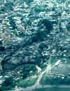
Shot
through window of commercial flight, June of 1994: view toward east. Stadium has
been expanded since 1969. Río Chiquito is visible in lower left.
 Enlargement
of previous photo shows red current of Río Chiquito. This stream flows through and
across redbeds of the Valle de
Ángeles Group. Red silt and clay increases the density of flowing water, making
it flow more rapidly and with greater momentum. Deforestation increases both runoff
(amount of water) and erosion.
 El
Picacho from aircraft (June, 1994). Deeply eroded ravines remain (in the absence of
rain) as evidence that water can and does move this soil and rock.
 El
Picacho as seen from Honduras Maya Hotel - January, 1996. Land in center of
photograph looks like a landslide. Buildings below landslides are obviously
threatened, but buildings above may also be at risk. As a slide moves downhill, it
may remove support that stabilized material higher on the slope.
 Just to
the left of previous photo. This also looks like a landslide. The wrinkled
surface (hummocky ground) is characteristic of landslides, even those that are not moving
today. Such slides are mobilized by removing support from their toe (lowest point),
adding weight to the slide (adding lots of water does that), or by reducing friction
between the slide and the underlying material (again, water does that). The U.S.
Geological Survey has landslide
information on the Web.
 Barrio El
Chile, June of 1996. I took this photo because the road ascends a landslide (see
hummocky ground, above), and, pads are being cut for homes on a steep slope (upper right
center).
 November, 1970: View (toward the south) of the Estadio Nacional from La Leona.
![]() June, 1994:
View (toward the south) from hotel window. Corner of Estadio Nacional provides point
of reference for comparison with previous image. Several homes cling precariously to
the oversteepened slope rising above the Río Chiquito.
June, 1994:
View (toward the south) from hotel window. Corner of Estadio Nacional provides point
of reference for comparison with previous image. Several homes cling precariously to
the oversteepened slope rising above the Río Chiquito.
Geological map of Tegicigalpa Quadrangle shows several large landslides.
Return to Latin American Studies Institute