Why has this remained a mystery for so many years? There it is, amigos, on a map published in 1966.
Some folks planned an expedition to Ciudad Blanca in early 1998 and tell us they found the city. They tell me that their "city", identified by 3-D remote sensing, is not their objective. Their "ruinas" are somewhere else. Some of their stereo images are still on the Web.
Does the topographic map published with the help of the Defense Mapping Agency, represent Official U.S. Policy on the location of Ciudad Blanca? Actually, this topographic map reads "CASA BLANCA" (White House), last rumored to be located in Washington, D.C. Seriously, there are 5 areas on this sheet marked as "Ruinas Arqueológicas", one of which is over 3 kilometers long and about 800 meters wide. This region is rugged (total relief on the 1:50,000 sheet > 800 meters, with relief > 100 meters typical of most 1 km square units), heavily vegetated (at least it was when the aerial photographs were taken in 1961) and wet (streams are mapped as flowing through most of the 1 km square cells between UTM reference lines). There are no trails or buildings shown on this 15 by 10 degree sheet. I suspect getting lost is the rule rather than the exception for new travelers entering this zone. The Privateers (Inc.) claim to have found the White City over a year ago but have not posted photos or detailed reports of their expedition.
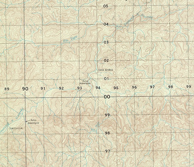 "Casa
Blanca" map.
"Casa
Blanca" map.
![]() Archaeological
ruins everywhere!
Archaeological
ruins everywhere!
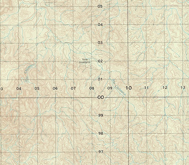 Something
this size should show up on satellite images. I wonder if the photo interpreter
recognized the difference between natural rock outcrops and anthropological
mounds.
Something
this size should show up on satellite images. I wonder if the photo interpreter
recognized the difference between natural rock outcrops and anthropological
mounds.
A lot remains to be discovered out there!
Archaeologist Chris Begley has been doing research in this area, the sort of careful scientific work that does not make for particularly exciting headlines or Indiana Jones scripts. His views on Ciudad Blanca are now posted on the Web.
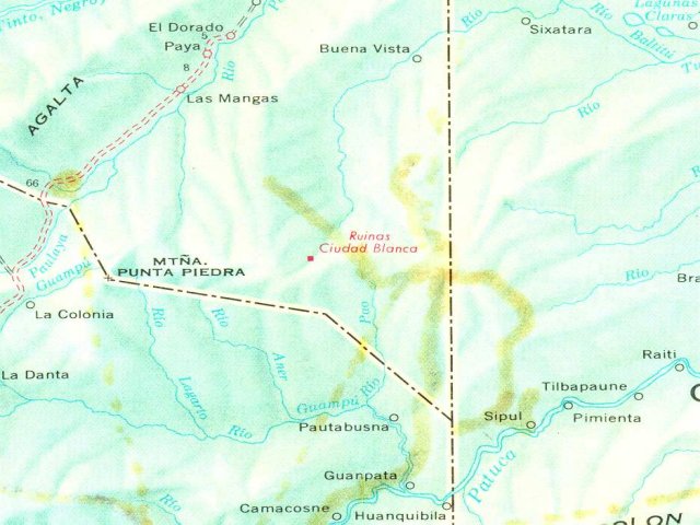
This Rand McNally & Co. map is based on the work of Dr. Jesús Aguilar Paz, the Mapa General de la Republica de Honduras (1:500,000) published by the Instituto Geográfico Nacional of Honduras. The original maps are now collector's items, as they are very detailed and out of print, having been replaced by the new official map.
The Ruinas Ciudad Blanca appear on the original map (but not on the 1994 edition - I have not checked the 1998 edition). Did Dr. Paz accurately map this feature?
Dr. Paz is highly honored as a diligent worker, meticulous map maker and miracle worker, having accurately mapped this rugged nation with little more than a compass, transit and a field office carried on the back of a mule. I do not think he would have placed anything on his map as a jest. I wonder if his field notes have been preserved. A room is dedicated to him and his work in the new national history museum in Tegucigalpa.
Did Dr. Paz see the city, or did he plot the location based on information supplied by local residents?
Or was this 'ciudad' added to the map by a technician on the staff of the IGN?
Additional speculation is welcome. Pass the rum, por favor.
Return to Latin American Studies Institute
Hits by the author checking up on the hit counter are also counted.